

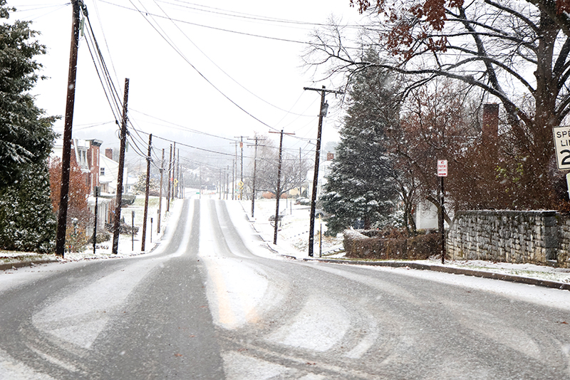
Meteorologists warn that residents along the Interstate 81 corridor could see a major winter storm this weekend, with up to 12 to 18 inches of snow possible across parts of the Tri-State area. AccuWeather meteorologist Chad Merrill said sleet could reduce totals in some areas, but forecasters agree that conditions could become hazardous by Sunday.
The National Weather Service’s Baltimore/Washington Forecast Office, covering Washington County and West Virginia’s Eastern Panhandle, predicted between 6 and 11 inches of snow by 7 a.m. Sunday. Meteorologist Jeremy Geiger said additional accumulation is expected through Sunday night into Monday morning, with below-freezing temperatures lingering through next week.
Southern Franklin County could see at least six inches by Sunday morning, according to David Martin, a meteorologist with the State College, Pennsylvania, Forecast Office. “The heaviest snow arrives Sunday and Sunday night,” Martin said, noting that precipitation may stretch into early Monday.
Extreme cold to follow snowfall
Geiger warned the region will experience the coldest air of the season next week, keeping roads slick and slowing cleanup efforts. “The snow will start sticking right away with ground temperatures near 20 degrees,” he said. Merrill added that any melting during the day will quickly refreeze overnight, making travel hazardous across the region.
Maryland Gov. Wes Moore declared a state of preparedness Jan. 21. He urged residents to stay off the roads and complete emergency plans ahead of the storm. “The safety and security of our residents is our top priority,” Moore said in a written statement.
In Pennsylvania, Gov. Josh Shapiro said emergency crews from the Pennsylvania Emergency Management Agency, State Police and PennDOT are working around the clock to prepare equipment and personnel for the storm. “Make sure you’re prepared—follow PEMA and the guidance of local officials,” he said in a social media post.
What to expect from the storm
Forecasters said snow in the Hagerstown area should start relatively light before becoming heavier and wetter later in the storm. Geiger said it will likely fall on the “in-between” side, not especially dry or wet, but dense enough to accumulate quickly.
Meteorologists are monitoring the storm’s track, which could shift snowfall amounts significantly. If the system moves south, more snow and less ice are expected. A northern track, however, could bring less snow but an increased chance of sleet and ice accumulation.
Temperatures are forecast to dip into the single digits overnight Friday into Saturday, according to Weather.gov. With frozen ground and plunging temperatures, water main breaks remain possible in areas such as Hagerstown, which has already experienced several this winter.
Safety reminders during winter weather
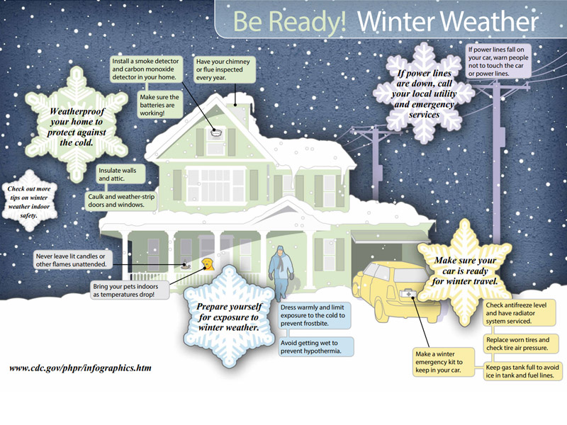
As residents prepare for the storm, the Centers for Disease Control and Prevention encourages the public to follow winter safety guidelines. The agency recommends limiting outdoor exposure, heating homes safely, checking on older adults and neighbors, and ensuring generators are properly ventilated.
The CDC advises keeping space heaters at least three feet away from flammable materials, never using a stove for heat and regularly checking carbon monoxide detectors. When traveling, officials urge drivers to monitor weather updates, keep emergency supplies in vehicles and avoid unnecessary trips during icy conditions.
For more information, readers may visit the CDC’s “Be Ready: Winter Weather Safety” resources at cdc.gov/winter-weather.