


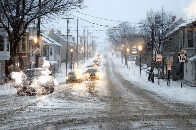
STATE COLLEGE, Pa. – A potent winter storm is set to blanket central Pennsylvania with snow starting Monday night and lingering into Tuesday morning, forecasters say.
The National Weather Service in State College predicts cloudy skies giving way to periods of snow after midnight Monday, with lows around 28 degrees and southeast winds at 5 to 10 mph. An 80% chance of precipitation could yield 1 to 3 inches of accumulation.
Officials are monitoring the system closely as it strengthens. Snow is expected to intensify mainly after 1 a.m., tapering off by Tuesday morning but leaving overcast conditions through the afternoon. Highs will reach near 38 degrees Tuesday, with east-southeast winds shifting to northwest at 10 to 15 mph. The chance of snow jumps to 100% overnight, adding another 1 to 3 inches.
Tuesday’s forecast calls for a messy mix early, with snow possibly blending with rain and sleet before 10 a.m., transitioning to rain and snow later. Calm winds will pick up to northwest at 6 mph in the afternoon, carrying a 90% chance of precipitation and new accumulations of 1 to 2 inches from snow and sleet.
By Tuesday night, conditions improve to partly cloudy skies, with lows dropping to 21 degrees under northwest winds of 3 to 6 mph.
Residents are urged to prepare for slick roads and potential travel disruptions as the storm delivers its first significant punch of the season.